
By Bill Church
Blog Post #2
In a previous blog post, we described our high altitude balloon launch on Friday, November 18th. In this post, we describe what happened next. Before diving into this post about the recovery of our balloon payload, however, it is worth explaining what we expected to happen to our weather balloon system during the flight.
Our weather balloon was filled with helium. We expected it to float higher and higher in the atmosphere. As it ascended, we expected it to expand. Air pressure drops as you gain in elevation. To keep the pressure inside and outside the balloon constant, the helium inside the balloon pushes outward and the balloon gets bigger. This happens continuously. Given the size of the balloon we chose, we expected it to reach an altitude of 25 km or 82,000 feet. At that altitude, it would likely be more than 6 meters or 20 feet in diameter! And then we expected it to pop. With no balloon, our payload box (and our radio and camera systems) would fall very quickly in the thin air. At some point within the first few minutes of falling, we expected the parachute to open and slow the descent rate of approximately 5 m/s. Throughout the journey, we expected our radio system to broadcast the balloon's location down to us on Earth. If all of these things happened as expected (they didn't) then we could use our predicted flight path (see Google Earth image below) to help us find our payload box, the cameras, and some pretty amazing pictures from the edge of space!
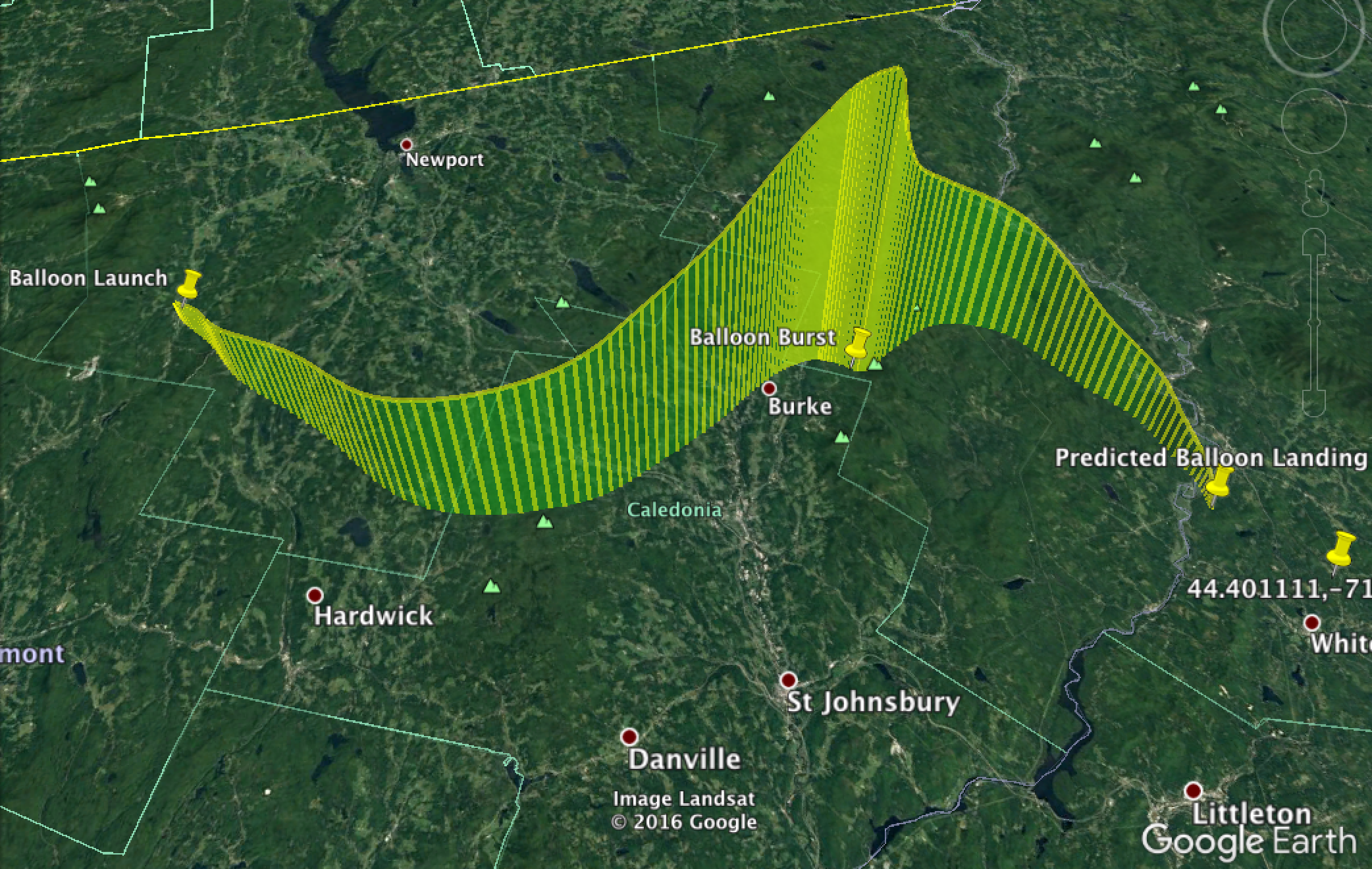
Image depicting our predicted flight path. We used a flight prediction tool from habhub.org and then plotted it in Google Earth. In this prediction, we expected the balloon to burst at 25 km above the earth's surface.
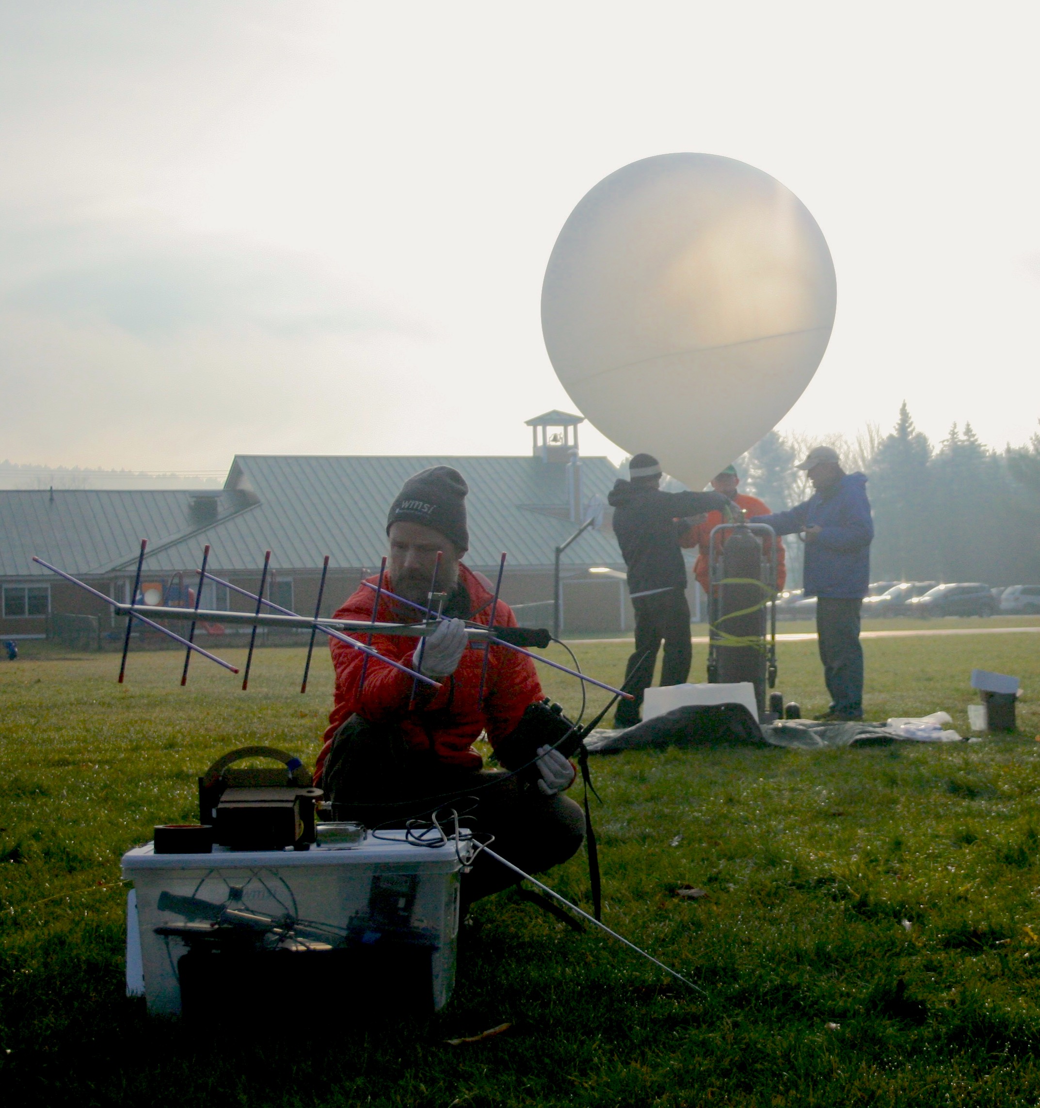
Conducting pre-flight radio tests.
The Recovery - Part I
Having just completed our successful launch, we next started to prepare for our successful payload recovery. I stared intently at the website (aprs.fi) we were using to display our flight path from Vermont to New Hampshire. The website displays map information derived from digital messages received through APRS (Automatic Packet Reporting System) radio systems. One of our balloon tracking systems relied on APRS. (See this link for a discussion of several different methods for tracking a balloon)
Unexpectedly, our balloon icon remained fixed. No new APRS location packets were being received from our balloon. We knew it was ascending and our primary tracking system was working. The APRS web based system, however, was not working.
I had been worried just before launch that something was wrong. When we first powered up our payload computer, I successfully logged and uploaded an APRS packet to the internet. I was pleased to see that our balloon icon properly updated its location from a previous radio test site in Bethlehem to Lowell, VT. But, 30 minutes later, right before launch, there were no new updates on the website.

Image from the website aprs.fi on the day of our launch. We intended on using this website to display our balloon flight path across the region from Vermont to New Hampshire.
To repeat a common phrase, hindsight is 20:20. At the time, I considered taking our protective foam box apart to reboot the system and do another radio test. But then I considered whether it could have been our receiving system that was at fault. We were using an experimental receiver made from a USB software defined radio attached to a Raspberry Pi based computer. On two previous high altitude balloon launches, we did not get APRS updates on the ground. Those updates only occurred when the balloon was high enough in the air to send radio packets to larger, more reliable ground based radio stations many miles away. It could have been our home-made receiver that was at fault.
The primary radio system was working fine and it would have taken about 30 minutes to open up our exterior box to reboot and test our radio. This was 30 minutes of daylight we would need on the other end of the day when we could potentially be hiking a few miles to recover our system. I decided to give the "go" for launch.
We let go of the balloon and it ascended toward the stratosphere. We laughed and cheered. Then we moved quickly to pack up and prepare to recover the payload box after its 2 hour flight. Our Profile School team (Kevin Briere, Dan Crosby, Ben Merrill, and four students) headed back to Franconia, NH to get more students for our search team. They were going to use the APRS website to track the balloon and coordinate a meeting place near the landing site with me and Jeremy on the WMSI team. Without the APRS website to depict our balloon's location, however, they waited for updates via text message.

Text representing the telemetry data we received on the ground from our balloon payload computer. Highlighted is the list of altitudes lower in the flight. These values are in meters. Here we see the balloon moved from 3240 meters to 3810 meters in 102 seconds (average speed of about 5.5 m/s).
Jeremy and I used our primary tracking system consisting of a Yagi directional antenna, a portable ham radio, and a laptop to manually track the balloon while driving directly from Lowell to the predicted landing area between Lunenburg, VT and Lancaster, NH. We kept a close eye on the altitude values as the balloon drifted upward. We needed the ascent rate to be near 5 m/s in order for our flight trajectory to be useful in recovering the balloon. We also needed to monitor the bursting height of the balloon. We based our flight prediction on a bursting height of 25 km. As it would turn out, the ascent rate prediction was spot on. The bursting height was not. Another technical twist to the plot of the day.
As we drove, we sent text messages with altitude updates to the passengers on the Profile team. 12,000 meters. Five minutes later -- 15,000 meters. Then 19,000 meters. We stopped the car to ensure we could listen to the balloon as it approached the predicted bursting height. It blew past it. 26730 meters. 27400 meters. In the following minutes, we watched very closely. 29951, 29974, 29988, 29932, 29928. Ahh, there it was, the burst. It was now descending. The balloon burst near 29988 meters (98,361 feet)! The Profile/WMSI team had successfully built a system to ascend into the region of the stratosphere called "near space!"

Telemetry data from our balloon at its highest altitude (A) of 29988 meters or 98361 feet! If you scan down the list of altitudes (B), you will see something interesting. The balloon seems to stop its descent at 28502 meters!
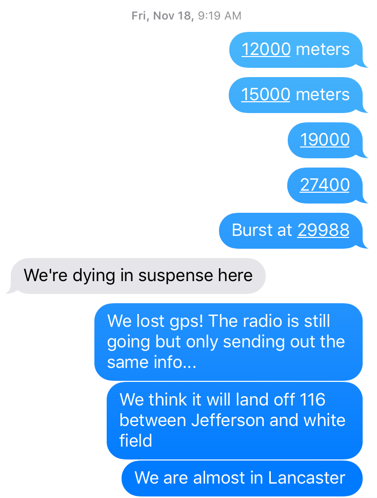
Text messages from WMSI's Bill Church to Profile STEAM Design Teacher, Kevin Briere. November 18th, 2016.
For the next 30 seconds, the balloon fell from 29988 meters to 28502 meters. Then something unusual happened! The signal from our tumbling payload computer, falling from the edge of space, repeated its location over and over again: 28502, 28502, 28502 meters. Surely this was false. Gravity doesn't just take a break. Prior to the 28502 meter reading, our payload box accelerated to a speed of nearly 44 m/s or over 95 miles per hour! This was expected. There is not enough air in this part of our atmosphere for our parachute to work.
But, something had gone wrong. Our payload computer was telling us it was hovering at 28502 meters. Another system failure. Our only conclusion was that either the GPS system had 'lost' its satellite lock or was completely shut down. Either way, we no longer had telemetry data. A 'needle' was falling from the sky into a very big haystack.
Next post: The Recovery - Part III!